Understanding how wetlands interact with the landscape can help property owners make informed decisions about water management, land use, and long-term property development.
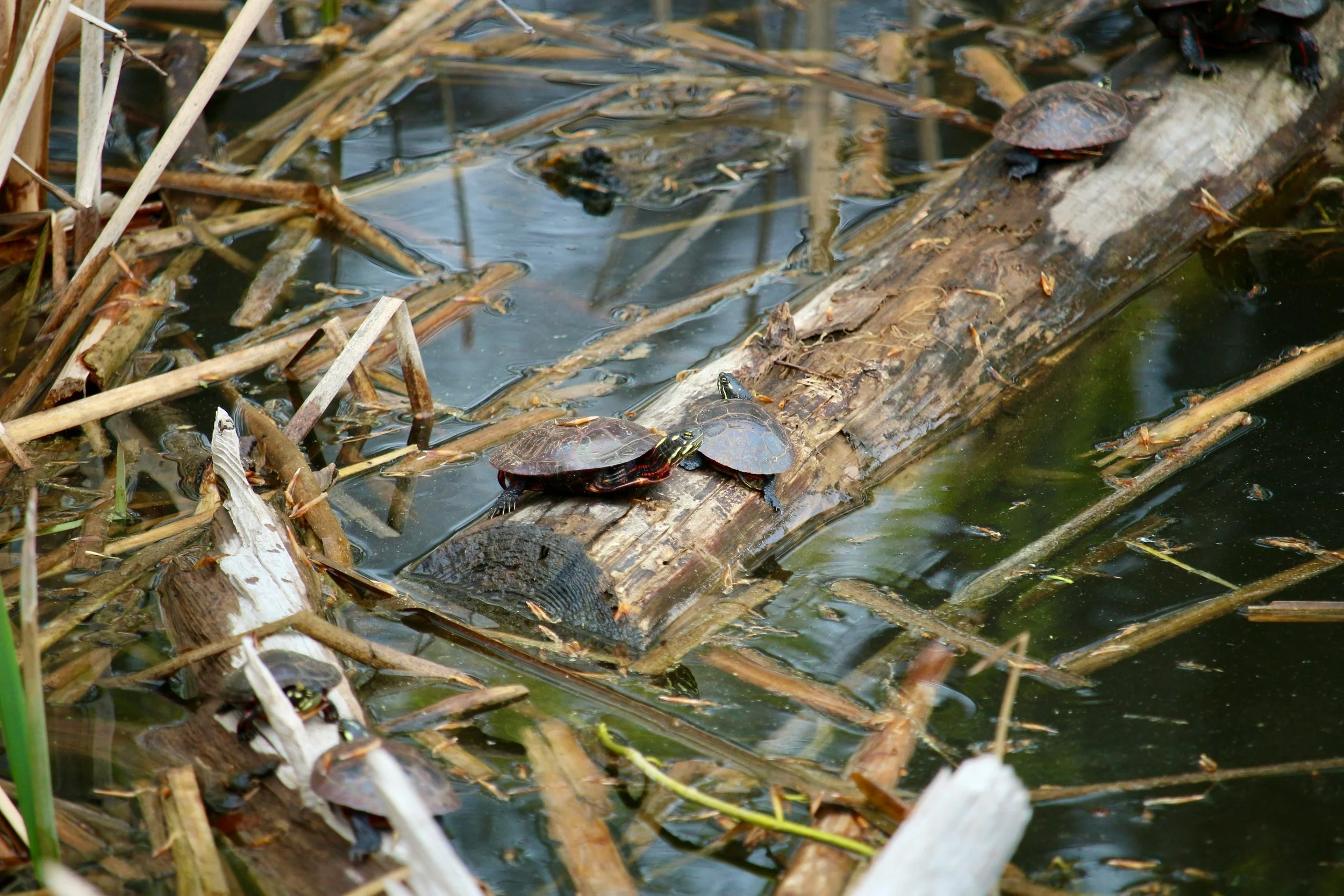
Wetlands are among the most distinctive features of a rural landscape. They influence how water moves across a property, provide wildlife habitat, and contribute to the natural character of the surrounding environment. For Virginia landowners, wetlands may also offer opportunities to incorporate thoughtful water-management features into a larger land-development plan.
But working with wetlands requires a different perspective from conventional excavation.
Whether you're developing a rural estate, planning a lake system, improving agricultural land, or evaluating an existing water feature, understanding the relationship between soil, water, elevation, and the surrounding landscape is essential.
Wetland development is not simply about moving earth or creating a low area where water can collect. It involves shaping land to support specific hydrological conditions while considering the property's intended use, environmental characteristics, and applicable regulatory requirements.
For property owners in Fauquier County and throughout rural Virginia, that distinction matters.
What Exactly Is a Wetland?
A wetland is an area where water influences the soil and vegetation long enough each year to create distinct environmental conditions.
Wetlands can occur in many forms, including marshes, wet meadows, forested wetlands, and areas along streams, ponds, and lakes. Some remain visibly wet throughout much of the year, while others may appear relatively dry during certain seasons.
Three characteristics are commonly considered when identifying wetlands:
Hydrology: The presence of water at or near the soil surface for periods of time.
Hydric soils: Soil conditions that develop when the ground experiences prolonged saturation or flooding.
Hydrophytic vegetation: Plants adapted to growing in wet or saturated conditions.
Standing water alone does not necessarily establish that an area is a regulated wetland. Likewise, an area that appears dry during a property visit may still show wetland characteristics in other seasons.
This is one reason property owners should avoid making assumptions based solely on appearance. Identifying wetlands and determining whether regulatory protections apply generally requires evaluation by qualified environmental professionals.
Natural Wetlands and Constructed Wetlands Are Not the Same
One important distinction in land development is the difference between an existing natural wetland and a constructed wetland.
Natural wetlands develop over time through interactions among water, soil, vegetation, and topography. Federal, state, or local regulations may protect them, depending on their characteristics and location.
Constructed wetlands, by contrast, are intentionally created or developed to serve a particular purpose. Depending on the project, they may be designed to support habitat, manage water, provide treatment functions, or form part of a larger water-management system.
A constructed wetland may incorporate carefully established elevations, water-flow patterns, shallow and deeper areas, and appropriate vegetation. These elements work together to create conditions suited to the intended function.
However, creating a wetland feature does not automatically make it a substitute for an existing natural wetland, nor does it eliminate the need to evaluate regulatory requirements.
Understanding which type of wetland is present—or being proposed—is an important first step in determining what work may be appropriate.
Why Wetlands Matter in Rural Land Development
For rural property owners, wetlands can influence far more than the immediate area where water collects.
They are part of a larger landscape system that includes drainage patterns, streams, ponds, surrounding vegetation, soil conditions, and elevation changes.
When these features are understood and incorporated into a property plan, they can contribute to a more cohesive approach to land and water management.
For example, a larger estate project may include a lake, surrounding wetlands, landscaped areas, and drainage features designed to work together. Rather than treating each component as an isolated improvement, the overall plan considers how water moves through the property and how each feature relates to the surrounding terrain.
This coordinated planning can be especially valuable on larger rural properties where water management, aesthetics, access, and land use intersect.
The Role of Topography and Water Movement
Successful wetland development begins with understanding the existing landscape.
Elevation changes determine where water naturally collects, how it moves across the property, and where it may flow during periods of heavy rainfall. Soil conditions influence how quickly water infiltrates or remains near the surface. Existing streams, drainageways, and other water features may also affect what can be accomplished.
These factors help establish whether a proposed wetland feature is appropriate for a particular location and what type of site preparation may be required.
Depending on the project, excavation and grading may be used to establish specific elevations, shape shallow and deeper areas, create channels, or construct supporting features such as berms and water-control structures.
The objective is not to force water into an unsuitable location. It is to understand the site's natural characteristics and determine how the proposed improvements can function within the broader landscape.
This is especially important in rural Virginia, where properties may include rolling terrain, wooded areas, existing waterways, and significant elevation changes.
How Wetlands Can Be Incorporated Into Lake Systems
One of the more interesting applications of wetland development is its relationship to private lakes and ponds.
A thoughtfully designed water feature can involve much more than a single excavated basin. Depending on the site and project objectives, a larger system may incorporate connected water areas, shallow zones, tiered wetlands, drainage features, and carefully shaped transitions between land and water.
These components can serve different purposes within the overall design.
Shallow wetland areas may provide habitat opportunities and create a transition between deeper water and surrounding land. Water-management features can help direct flow through designated areas. The placement and elevation of different components influence how the system functions.
The design must account for the water source, expected flow patterns, soil characteristics, and intended use of the finished feature.
It is also important to understand that a lake or pond with wetland features is not automatically a functioning stormwater treatment system or a regulated wetland mitigation project. Those outcomes require appropriate planning, professional evaluation, and, where applicable, regulatory approval.
For property owners considering a private lake or larger water feature, discussing these possibilities early can help ensure the excavation and land-development work supports the overall vision.
Permits and Environmental Considerations Should Come First
Wetland-related projects require careful attention to regulations.
In Virginia, certain wetlands, streams, and other aquatic resources may be subject to federal and state protections. Activities such as filling, dredging, grading, excavating, or altering water flow in regulated areas may require authorization before work begins.
Specific requirements depend on the location, site characteristics, type of activity, and potential environmental impacts.
In some situations, property owners may need a wetland delineation to identify the boundaries of existing wetlands. Other projects may require environmental review, engineering plans, or coordination with regulatory agencies.
Fauquier County also administers erosion and stormwater management requirements for applicable land-disturbing activities. These requirements protect water quality, manage stormwater, and reduce soil erosion. The scope of review depends on the proposed work and applicable regulations.
This is why you should not assume a project is exempt from permitting simply because it is on private property.
Before altering an existing wetland, stream, or other potentially regulated feature, consult qualified environmental professionals and the appropriate authorities. Understanding the requirements before excavation begins can help prevent costly delays, redesigns, and compliance issues.
Excavation Is Only One Part of the Process
Once a project has been evaluated and the necessary plans and approvals are in place, excavation and site preparation may become part of the construction process.
Depending on the design, the work may involve clearing selected areas, establishing elevations, shaping basins, constructing berms, preparing access routes, or creating the transitions between different water features.
Precision matters because small elevation changes can affect how water moves and where it collects.
The work also needs to account for the surrounding property. During construction, consider equipment access, material handling, erosion control, and protecting adjacent areas.
For larger projects, coordination among the property owner, environmental professionals, engineers, and the excavation contractor helps ensure the approved plans are carried out properly.
An experienced excavation contractor understands the importance of working within the established project requirements and recognizing how the construction work fits into the larger plan.
Planning for Long-Term Performance
Wetland and water-management features should be evaluated with long-term conditions in mind.
Water levels fluctuate. Vegetation changes. Sediment can accumulate. Storm events may affect surrounding areas. A system that looks attractive immediately after construction still needs to function as intended as the landscape matures.
That makes the initial planning and construction approach especially important.
Property owners should understand each feature's intended purpose, what maintenance may be necessary, and whether monitoring or ongoing management is required. Projects designed for environmental mitigation or stormwater management may have specific performance standards and maintenance obligations that differ from those of a private landscape feature.
Thinking beyond construction helps set realistic expectations and supports better long-term decisions.
Experience Makes a Difference on Complex Rural Properties
Wetland development often involves several interconnected aspects of land improvement. Grading, drainage, excavation, water control, access, and the surrounding landscape all influence the finished result.
That complexity makes experience especially valuable.
Monomoy Services has been working on rural Virginia properties since 1990, bringing decades of excavation and land-development experience to specialized projects throughout Fauquier County and surrounding communities.
The company's capabilities include site preparation, grading, drainage and erosion control, lake and pond construction, wetland development, roadwork, and custom excavation for estates and rural properties.
Among its specialized work is developing a lake system incorporating tiered wetlands—a project that reflects the importance of considering water features as part of a larger landscape rather than isolated improvements.
Every property presents its own conditions and opportunities. The right approach begins with understanding those conditions, working within the appropriate plans and requirements, and excavating with care and precision.
A Thoughtful Approach to Land and Water
Wetlands are an important part of Virginia's rural landscape. Whether naturally occurring or incorporated into an approved development project, they require an understanding of how water, soil, vegetation, and terrain interact.
For landowners considering a lake system, water-management improvement, or larger rural property development, the most successful projects begin with careful evaluation and a clear understanding of the property's characteristics.
With proper planning, qualified environmental guidance, and experienced excavation, land improvements can support a property's intended function while respecting the surrounding landscape.
Planning a Lake, Wetland, or Rural Land Improvement Project?
Monomoy Services provides specialized excavation and land-development services throughout Fauquier County and surrounding Virginia communities. From grading and drainage to lake and pond construction, wetland development, and custom estate improvements, the team brings decades of experience to projects that require thoughtful planning and skilled execution.
Contact Monomoy Services to discuss your property's needs and the excavation work needed to bring your project to life.